Oregon's Night Skies
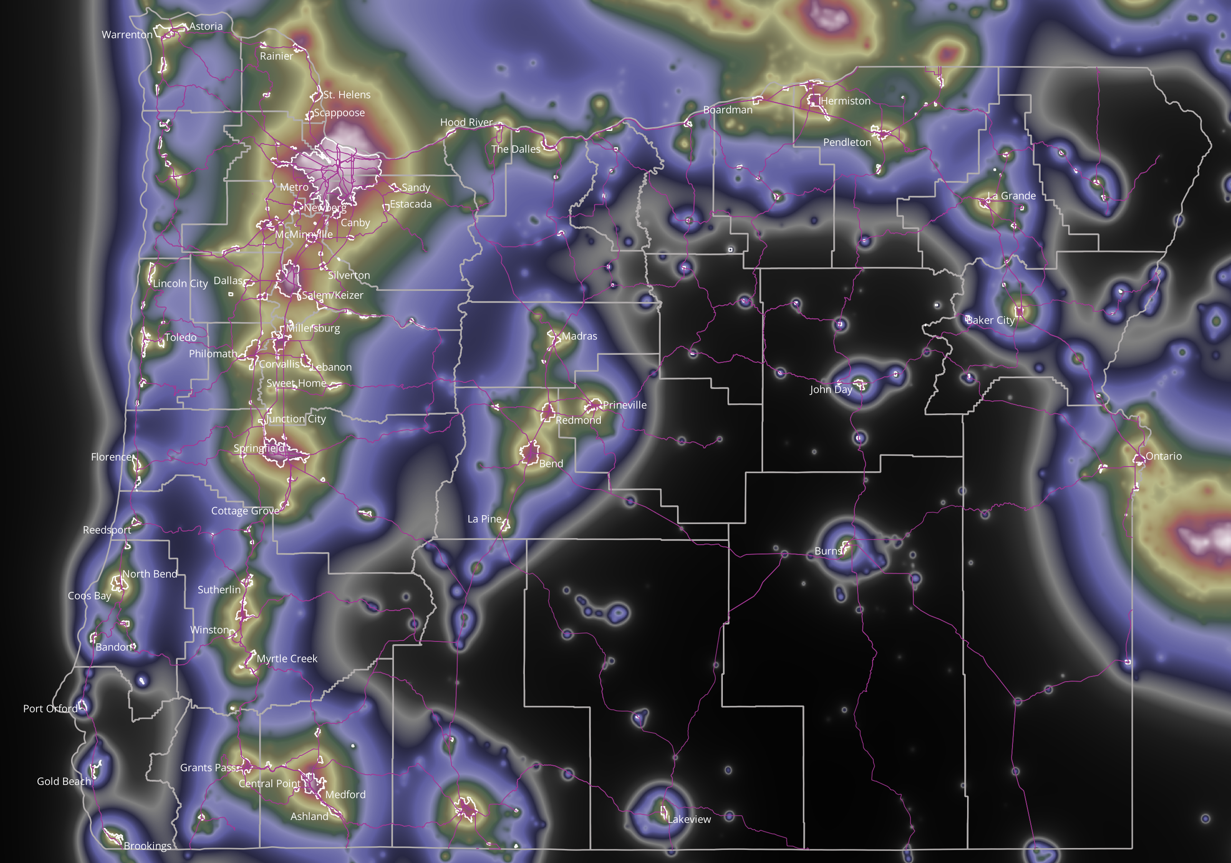
Large areas of Oregon still have dark skies at night -- the green, purple, and especially the black areas in the map have dark, Milky Way skies. The white, red and yellow areas have light-polluted skies in which few stars are visible.
The map shows the amount of skyglow directly overhead at each spot. The amount of skyglow is derived from night time satellite images, which were taken at about 2AM during the year 2022. The map shows county boundaries, main roads and the urban growth boundaries of Oregon cities. Each city lies under a dome of skyglow that extends far outward, caused by wasted light, escaping upward and scattered by the atmosphere.
Here are two links for finding dark-sky locations:
www.lightpollutionmap.info
www.darkskyfinder.com